Damaged satellites: Reliably define proper motion
Uncontrolled objects or even damaged satellites in Earth orbit pose massive risks to functioning satellites. Since April 2012, the European environmental satellite ENVISAT has also been flying around the earth unable to maneuver. The Fraunhofer Institute for High Frequency Physics and Radar Techniques FHR has developed methods to precisely determine the intrinsic rotation of this satellite - and thus effectively support a "de-orbiting mission".

Accidental satellites are not simply space debris, they pose great dangers to orbiting flying objects. The former environmental satellite ENVISAT is one of the largest spacecraft ever catapulted into orbit by the European Space Agency ESA. Back in 2002, the €2.3 billion environmental satellite, which weighs around eight tonnes, was launched and reliably performed its duties - monitoring our Earth's climate, oceans and land areas - until 2012. Then it lost contact with the ENVISAT satellite.
The Earth observation satellite flies in a low-Earth orbit at an altitude of about 800 km - a region of the Earth's orbit with a high population density of space objects. "Space debris is a big problem in near-Earth spaceflight. The now uncontrolled flight of ENVISAT means an everyday risk of collisions with active satellites and spacecraft," emphasizes Dr.-Ing. Delphine Cerutti-Maori, Space Business Unit Spokesperson at Fraunhofer FHR. "In addition, further risk potential arises because collisions can contribute to the creation of new debris, which in turn could collide with other objects - a dangerous snowball effect."
"De-orbiting" with method
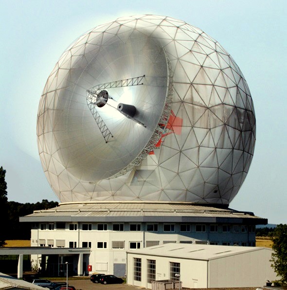
In order to deal with the situation properly, ESA is currently looking for solutions to bring ENVISAT into a lower orbit and finally to let it burn up in the Earth's atmosphere in a controlled and safe manner. However, such so-called "de-orbiting missions" can only succeed if the satellite's intrinsic rotational motion is correctly determined beforehand. Only then can it be determined which method should be used to capture the satellite. "Our TIRA space observation radar combines a Ku-band imaging radar and an L-band target tracking radar," explains Dr.-Ing. Ludger Leushacke, Head of Department Radar for Space Observation at Fraunhofer FHR.
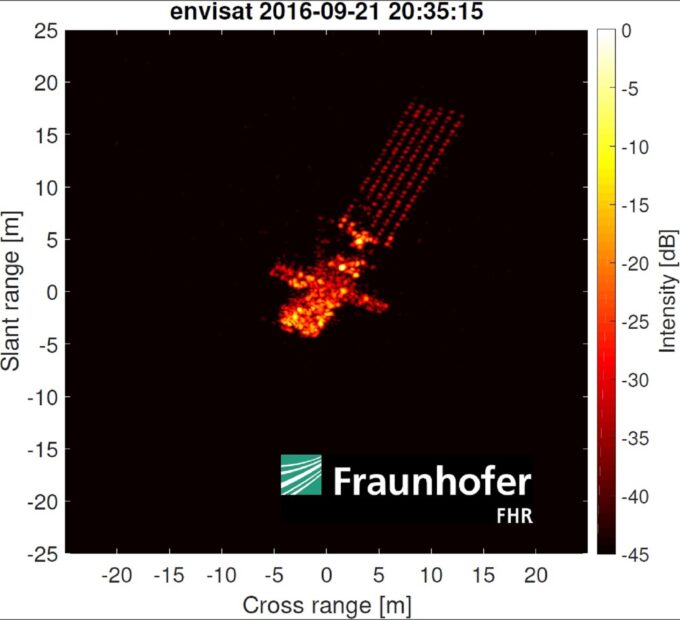
"In contrast to optical systems, our radar system offers decisive advantages: Complete independence from local weather, operational capability during the day and at night, and a resolution that is completely independent of the object's distance. In addition, we can determine the rotational speed of both fast-rotating objects such as ENVISAT and slow-rotating objects," explains the head of the radar department at Fraunhofer FHR. The raw radar data from ENVISAT recorded with TIRA are processed and subsequently evaluated using special methods developed at Fraunhofer FHR.

proper motion of space objects
Precise knowledge of the proper motion of space objects is crucial for supporting space missions. It enables acute assistance and advice in emergency situations, supports concrete damage assessment and analyses the alignment of solar panels to the sun to check whether the necessary power supply of a satellite is ensured. In addition, it provides valuable information and decisive criteria for the planning of de-orbiting missions.
Long-term analysis of the self-rotation
High-resolution radar images are generated by using the relative rotation of the observed object to the stationary radar system. In doing so, the object is illuminated from different viewing angles. However, the transverse scaling in the radar image depends on the actual rotation speed, which itself is to be obtained from the data first. "To overcome this problem in image acquisition, our team of experts has developed a suitable methodology that uses wireframe models of the objects to correctly estimate the transverse scaling," Cerutti-Maori explains. "For this purpose, a wireframe model of the object is manually projected on different images of a passage. The time evolution of the projections over a passage can then be used to reliably estimate the rotation vector of the object."
No collision
For the analysis of the long-term development of ENVISAT's proper motion, observations from the period from 2011, shortly before contact was broken off, to 2016 were used. In regular service, ENVISAT rotated relatively slowly at about 0.06°/s, which corresponded to one revolution per Earth orbit. Shortly after the link was broken on 8 April 2012, an increase in proper rotation to nearly 3°/s was observed, about 45 revolutions per orbit. This increase in proper rotation speed does not indicate a collision with other objects, as the increase was gradual and not sudden, is the conclusion of the researchers at Fraunhofer FHR.
Since mid-2013, a slowdown of the rotation speed can be observed: It was around 1.6°/s at the end of 2016. "Our investigations can contribute significantly to supporting a controlled removal of the damaged ENVISAT in the future, if ESA decides to do so," says Leushacke.


